Our founder and CEO, Will Bateman, recently gave a webinar for The Institution of Environmental Sciences in which he described the problems our coastlines face and how we, at CCell try to solve them. What follows is a transcript of the first section of this talk.
"Hello everybody, I am just going to talk you through what we've been doing at CCell as Rihanna has explained. What I want to start with is, just dive straight in there, what is it that we actually do.
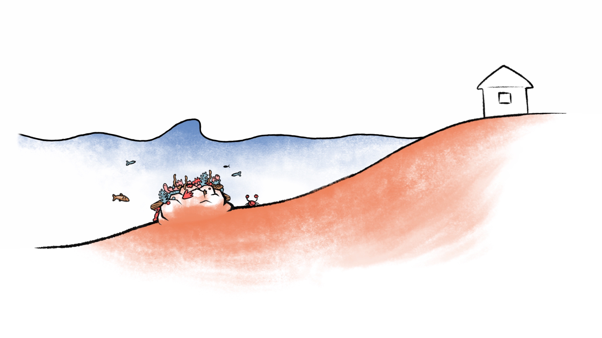
So, we take energy from waves, we use this to grow rock which we grow underwater, and we use that rock to grow or make reefs. We're using that to protect coastlines, and the objective here is also to give corals a new home.
I was in Mexico at the beginning of September, and it really brought home to me why exactly we were doing this. I was over there for some meetings with some hotels and we were also shooting some video for our crowdfunding campaign that we were about to launch.
This picture here basically illustrates very clearly the profound issues that they are experiencing in Quintana Roo and also in many areas around the world.
When we were there the cameraman asked me to actually rent out this deck chair on the right-hand side, and I was shown to the reception, I was approached by the guys there, and I said – “I want this deck chair”. They showed me something that looked a bit like a chessboard, but a little bit larger and they pointed to the middle of it and said – “This is your deck chair”, and I said – “No, no, no I want the one on the seafront” and in my best Spanish we negotiated for a little bit and they essentially said – “Look, this is that deck chair”.
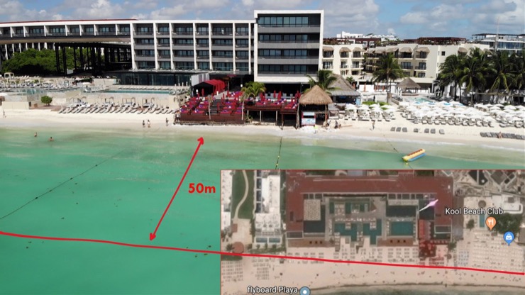
So, they had lost between eight to ten rows of deck chairs in a very short period of time. That equates to between 30 to 50 meters of beach. The beach initially, only about 2 years ago, was around the back, and all of this has essentially been eroded away. This is a Google Map of actually where the beach was, and I am guessing Google took that picture around 2, maybe 3, years ago and you can see that's where the bandstand is/was originally out there, and they've lost all of this sand in the meantime.
Now, staying with google, if we type in beach erosion, then Google will very nicely return to you about 41,700,000 results. Look through the image search and you'll see pictures that are pretty much the same, beach erosion and the loss of sand is clearly a global issue. This is not something that is very particular to any one part of the world and if you look at the references you will see ones to everywhere; in every country in every part of the world.

But, what is interesting is beach erosion is not something that's new, it's been going on for many years, and for example, the white cliffs of Dover are white because of steady erosion. So what's actually happening? Now, this is from Dooagh in Ireland, and 35 years ago they woke up to discover that their beach had disappeared. They had this beach, which you can see in the bottom left-hand corner and it suddenly looked like the top left-hand corner. They were obviously quite distraught. Then in May 2017, a number of years later, it suddenly reappeared. In both cases, this was after a very large storm had come through and hit their coast.
At the start of this year, in January, they woke up to discover it had actually disappeared again. Sadly, it had gone back to its eroded state. What's interesting about this is that overnight you can have large quantities of sand move into and out of the region by storms. So storms are not always bad; they just move sand around, the issue is that it doesn't necessarily do what you want it to do at the appropriate time.
Now, staying within the UK, on the right-hand side here we have got the Scilly isles. They obviously, being an island or a collection of small islands, are very worried about erosion and the state of their island. They monitor things very carefully and what they've been doing for a number of years, 10-20 years, is producing diagrams, every year, showing how much sand has moved around the islands. The red shows where you've got accretion, build-up, of sand and blue shows where you've got a reduction in sand. Very often, you see these two sort of sitting next to each other. What's really interesting about the work they have done is that when they actually calculated the amount of sand around all of those islands and they find that is relatively constant. It's not changing as much as you might otherwise think. But it is just being quietly moved backwards and forwards between different parts of the islands and different beaches, but why is that?

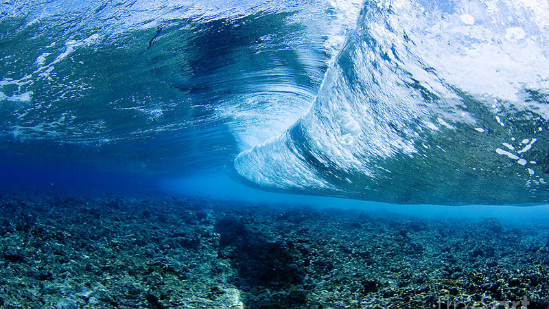
As a generality, if we look globally, we find that around about 70% of coastlines are experiencing increased erosion. A large part of that is due to changing wave patterns.
Smaller waves, seen in the top diagram, generally speaking, move sand in towards a beach. So they are good, we want those. The issue is when we have larger waves, in particular when we have these sort of pounding crashing waves that actually take sand away. They are actually moving sand offshore. But big waves are not always bad, so for example in Hawaii, where they have fantastic beaches, you'll find they also have very large waves. The two can coexist. The issue is that the beach and the profile of the beach tend to be conditioned to the average conditions of the waves over relatively large periods of time. So when you suddenly change those conditions, either you make them a little bit bigger, or you have more storms coming through, then suddenly you have quite significant changes to the beach.
As you'll all have gathered from the fantastic series by David Attenborough, the global climate is changing at a rapid pace. In particular, we have seen an 80% increase over the last 30 years in the frequency of severe storms and hurricanes. Hurricanes are also actually getting larger; we have seen this very recently with Dorian in the Grand Bahamas. But it is the frequency that is particularly worrying, and last year we actually saw hurricanes almost queuing up to cross the Atlantic.
Now, on top of this, as David has also shown very eloquently, we have seen a gradual erosion of glaciers and an increase in sea levels. At the moment the seas are rising at 0.3 mm a year, which doesn't sound like a huge amount, 10 centimetres over 30 years, except this pace is set to increase. A lot of the computer models are estimating that by the end of this century we might see a 1-2.5 meter rise in sea levels. That range is largely down to how we as humans decide to act; how we cut back on our CO2 emissions. Now, the statistics are quite horrific; 10% of the global population lives less than 10 meters above the current sea levels. So you may think: “Ok well, if they are above the 2.5m they are going to be fine”, but if those storms actually start to pick up, that loss of 2.5 meters can have quite dramatic effects. This is what we actually saw it in the Grand Bahamas, which also then leads into, just to name a couple of examples, some of the major cities of the world, like Osaka seeing 5.2 million people displaced by 2.5 meters of water. In Shanghai we'd be displacing 7.5 million, and, what I was amazed to discover,
Miami would be completely displaced. Under a 2-degree warming scenario, which I think to be very likely, the entire bottom third of Florida would be submerged by the end of this century. Again, let's bring this back to England and what would that look like.
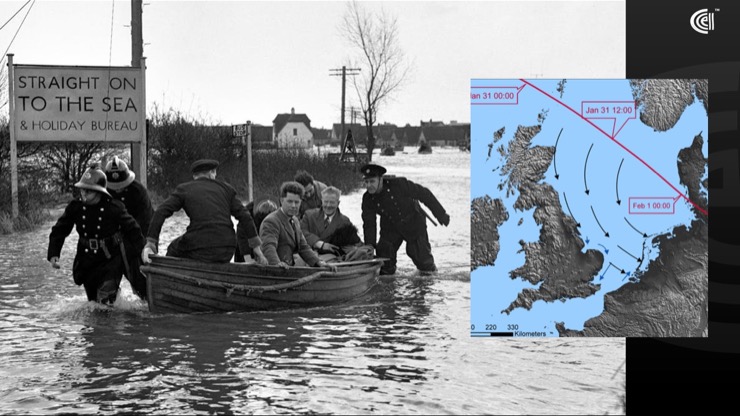
In January 1953 the UK and Netherlands and Belgium experienced the worst flooding event ever recorded. During that time over 300 hundred people died in the UK and in the Netherlands over 1,900 people died in one night. The event was triggered by a combination of three factors; first of all, there was a spring high-tide, which is completely predictable and normal and happens every year, second we had a 1.5m high-water mark in the North sea. But what really caused the problem was that we also had some very strong winds coming down the North Sea, which essentially pushed the water up against the land, basically across Holland. So that's where you've got your storm surge from, and to really cap it all off we also had this low-pressure front that was passing over the North Sea at the same time, which essentially just sucked up the water.
What's really interesting is, playing a little bit with the numbers, it ended up with sea levels being around 2.5 meters higher than the predicted high tide mark would've been, which produced the amount of flooding and the loss of lives I mentioned before.
Since then we have gone back and beefed up our defences, and putting up an awful lot of measures to prevent this from happening again. The seven barrier arches are a good example of that. But, when you actually look at what happened along this coast it wasn't that they didn't have defences, or that the defences weren't necessarily adequate to cope with 2.5 meters of water height, it was the fact that the waves that came started actually to undermine those defences. There were something like 1,200 breaches of the flood defences over 24 hours, and it caused an awful lot of these defences to fail, and as a result, the water then had free access to flood in.
How can we address that? Fortunately, as it is often the case, nature has a solution. Coral reefs are a phenomenal means of actually fighting back against larger waves and some of the issues we have just seen above. In fact, there are 200 million people who are protected more or less daily by the presence of coral reefs. Reefs achieve this simply by causing waves to break; crucially they take the energy from these waves.
You can see the benefit of just a very simple reef pretty much everywhere you go, if you look at the Bahamas just after hurricane Matthew in 2017, I took these two photos, and these are actually sequential. The picture on the top right is actually the picture you see below but at a distance, and the only difference between this two is that on the lower picture there was a reef about 400m out at sea. It wasn't a particularly big reef, but on the upper picture there was no reef at all. What you see is that the hurricane caused a lot of wind damage to a lot of buildings. But in terms of actual properties on the coastline, where there was a reef, they saw no real storm damage. Further up, pretty much everybody, every property on this part of the coast experienced some form of damage, including complete loss of their gardens in some cases.
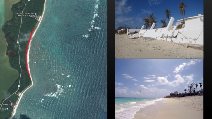
Now just to present this from a slightly different perspective, if we go back to our friends at Google and we look at what they have done in Google Maps and you look at the coast of, say, Quintana Roo, you will very often see features like this where the sea is cutting away at the land. If you look a little bit further out you will very often see this is where there are wave breaks, so you have a reef out here that is actually protecting this part of the land, where you have got a break in the reef you see this dip of eroded land. Reefs, without doubt, have a phenomenal effect on our coastline, they are clearly very effective, but they are unfortunately dying.
We have lost over 25% already, and something like 60% of those that remain are threatened. In the Caribbean, where we are predominantly working at the moment, they have lost about 70-80% of their coral reefs. So, what can we do?
Really just bringing all of this together, we are trying to replicate what a reef does, with an added twist. We start by putting a steel mesh structure on to the seafloor which, we then power the structure with wave energy, or we can use solar panels, and we grow an artificial reef to provide protection that a natural reef may have otherwise provided."